The TDS TerraGuide navigation package puts digital topographic maps and nautical charts in the palm of your hand”helping you find your way quickly and easily. The TerraGuide package includes the rugged TDS Recon handheld computer, a GPS CompactFlash card, an Extended CF-Cap, TerraGuide software for your PC and Recon and full-color 1:250,000-scale maps for the continental United States. More detailed state maps are available separately. With TerraGuide, you can plan a route, mark the waypoints and plot your position with real-time GPS data.
Find your way from the palm of your hand
Jan 23, 2009
More Products


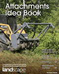
The Attachments Idea Book
Landscapers use a variety of attachments for doing everything from snow removal to jobsite cleanup, and regardless of how often they are used, every landscaper has a favorite attachment.
Download