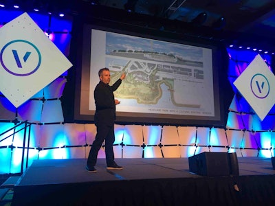
 Adam Greenspan discusses past project using Vectorworks during the keynote presentation.
Photo: Jill Odom
At the Vectorworks Design Summit, landscape architects from across the country gathered to network and learn about the new software capabilities.
Some landscape designers, like Diana Grundeen, owner of Trio Landscaping based in Minneapolis, Minnesota, are relatively new to Vectorworks and have to make a concentrated effort to shift to the new technology.
Grundeen has been using Dynascape for the past 15 years and she says the change is like learning a new language. Despite it being the busiest part of the year for her, Grundeen knew that coming to the design summit would help her with the learning curve.
Some of the features that drew her to Vectorworks include the easy toggling between 2D and 3D modeling and site modeling, which allows her to have quantitative knowledge such as how many cubic yards of soil will need to be removed at a jobsite.
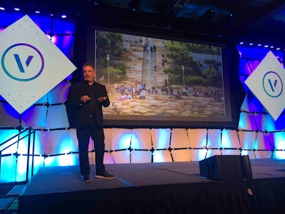
 Barangaroo Reserve’s topography was created by methodically stacking sandstone blocks.
Photo: Jill Odom
During the keynote presentation, Adam Greenspan, a partner at PWP Landscape Architecture, displayed just how powerful Vectorworks Landmark is for completing some of its massive jobs, even when they are on the other side of the globe.
One example of this was the Barangaroo Reserve in Sydney, Australia, which transformed a disused container terminal into a 22-hectare waterfront precinct. The firm built up the site’s topography using sandstone and wanted it to look like existing headland.
“Vectorworks helps us translate very technical specifications into normal people’s language,” Greenspan said.
The landscape architecture firm has even used Vectorworks to plot full scale mockups of various pieces, such as park benches and fountains, for one of its ongoing projects, the Transbay Transit Center in San Francisco.
During the sessions offered, presenters demonstrated how different features could be used on a regular basis. Bryan Goff with Grey Leaf Design and Eric Gilbey with Vectorworks led a session on water-efficient landscape design, showing how the software’s hydrozones can help landscapers stick to a water budget.
Vectorworks Landmark includes premade worksheets, including the EPA’s WaterSense and California’s Model Water Efficient Landscape Ordinance (MWELO).
Goff walked through how one could use the worksheets to calculate a property’s water usage and how by tinkering with the hydrozone properties one could create a more sustainable landscape. Users can edit hydrozones to have certain colors based on their class of high, medium or low water use making it more visually obvious where there is high water usage.
“It’s about generating the information so you can make good design choices,” Goff said.
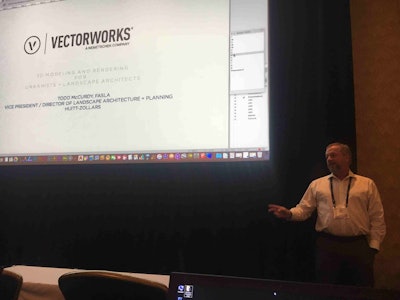
 Todd McCurdy talks about 3D design.
Photo: Jill Odom
Another session covered 3D modeling and rendering for landscape architects and looked into the minor details that can help make renderings far more believable.
Todd McCurdy, vice president and director of landscape architecture and planning for Huitt-Zollars, demonstrated the power of the Heliodon tool for creating realistic shadows and how textures can make a huge difference for 3D designs.
He advised designers to only add the level of detail to where the focus is going to be and to keep everything else simple to keep the rendering speed relatively fast. He showed how there were multiple ways to create the same thing, depending on the user’s workflow preferences.


